Lagatar24 Desk
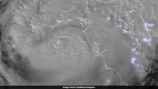
Florida: Satellite footage from the National Oceanic and Atmospheric Administration (NOAA) has captured the full force of Hurricane Milton’s path as it made landfall on Florida’s west coast near Siesta Key. Released on Thursday, the footage reveals the massive swirling storm system, with frequent lightning strikes lighting up the hurricane’s eye, encircled by dense cloud bands extending for hundreds of miles.
Milton, which hit the coast as a Category 3 hurricane, brought winds of up to 120 miles per hour, leaving widespread destruction in its wake. Nearly 2 million people were left without power, trees were uprooted, homes were destroyed, and several tornadoes formed across southern Florida during the storm’s passage.
NOAA’s Satellite Imagery Highlights Lightning and Tornado Activity
The satellite imagery, captured by NOAA’s GOES-East satellite, provides an in-depth look at the storm’s intensity. “Notice the frequent lightning being detected by the satellite’s GLM instrument,” NOAA stated in their release. The storm’s impact was seen stretching across Florida, where the images showed the scale of devastation.
Milton Weakens But Continues to Cause Damage
Although the storm weakened to a Category 1 hurricane as it moved further inland, it continues to cause significant damage. Emergency response teams are using the satellite data to coordinate relief efforts across affected areas.


