Lagatar24 Desk
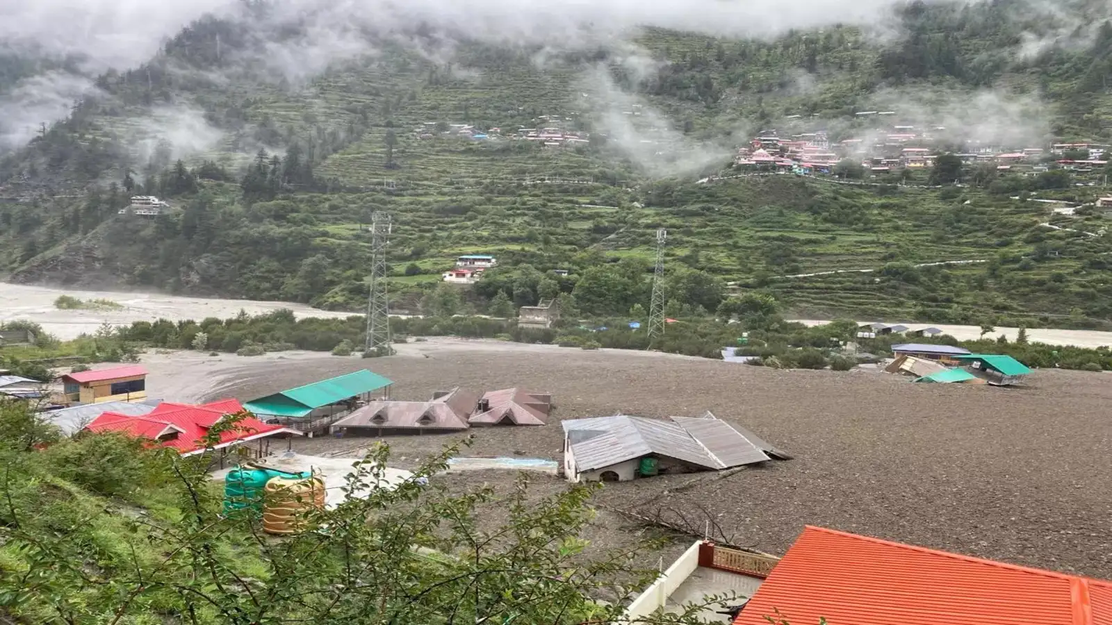
Uttarkashi: A sudden cloudburst on Tuesday unleashed flash floods and landslides across Uttarkashi’s Dharali village near Harsil, killing five people and leaving dozens missing. The natural disaster washed away homes, parts of an army camp, and severely impacted transportation and rescue efforts.
Why Uttarkashi Faces Frequent Disasters
Uttarkashi lies in the heart of the Garhwal Himalayas, a region known for steep mountain slopes, unstable geology, and glacial rivers. The Bhagirathi, Mandakini, Alaknanda, Dhauliganga, and Yamuna rivers flow through narrow valleys, swelling quickly during monsoons due to glacial melt and torrential rainfall. Combined with unchecked development, deforestation, and frequent road construction, the region becomes highly susceptible to flash floods and landslides.
Origin and Importance of Bhagirathi River
The Bhagirathi originates from the Gangotri Glacier’s snout, Gaumukh, at 4,000 meters above sea level. Flowing through Gangotri, Harsil, and Tehri, it meets the Alaknanda at Devprayag to form the Ganga. While Alaknanda contributes more water, Bhagirathi is culturally considered the Ganga’s source due to religious significance.
Dharali and Mukhba: Sacred Yet Vulnerable
Dharali, a village at 2,680 meters, lies along NH-108, close to Harsil and 14 km before Gangotri. Nearby, Mukhba serves as the winter seat of Goddess Ganga, where her idol is worshipped when Gangotri Temple becomes inaccessible due to snow. This cultural significance draws pilgrims despite the geographical risks.
Access and Ongoing Rescue Efforts
Harsil is around 200 km from Dehradun and about 440–480 km from Delhi. With roads damaged and blocked, rescue teams are struggling to reach the affected areas. Heavy equipment is being used to clear debris, but weather conditions remain a challenge. Authorities are urging the public to rely only on official updates and avoid rumors.


