


Lagatar24 Desk
Uttarkashi: High-resolution satellite images from the Indian Space Research Organisation (ISRO) have provided critical insights into the extent of destruction caused by the August 5 flash floods in Uttarkashi, which killed five and left over 50 missing. Experts believe a glacial pond burst triggered the disaster.
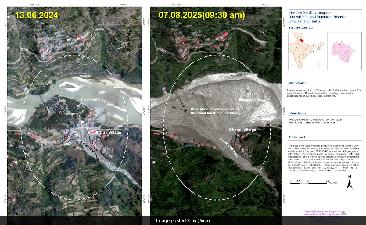
Cartosat-2S Maps Scale of Damage


Two days after the floods, ISRO’s Cartosat-2S satellite captured detailed images showing a vast, fan-shaped deposit of mud and debris covering nearly 20 hectares at Dharali village, where the Kheer Gad stream meets the Bhagirathi River. The National Remote Sensing Centre (NRSC) in Hyderabad compared the August 7 images with cloud-free pre-flood visuals from June 13, 2024, revealing widened stream channels, altered river morphology, and extensive damage to infrastructure.
Guiding Relief and Restoration Efforts
The mapping is helping search and rescue teams identify submerged areas, locate priority zones, and plan restoration of connectivity to cut-off villages. Many houses, roads, bridges, and plantations have either vanished or been buried under thick layers of mud and sediment. ISRO noted that several buildings in Dharali remain submerged and stressed the growing vulnerability of Himalayan settlements to natural disasters.


